 Archief
The publication Maak Plaats! (Make Space!) presents a new vision on the use of space in the province of Noord-Holland. The time is ripe for transit-oriented development; a smart growth strategy focused on a more efficient use of the existing city and its existing infrastructure network. The book has received international acclaim from among other the design blogs | It's Nice That | and | FastCodesign |.
Such a growth strategy is no longer based on the future value of development but on the current value of better utilisation. This new strategy will bring new opportunities for the Netherlands with its unique small-scale urban structure and network.
Information/downloads
| Maak Plaats! | (129MB, Dutch with English summary on pages 224-231)
| Make Space! | (English presentation)
| E-mail | or call us at +31 10 737 0340
Related pages
| Update - SprintCity #6 - English version | (2014)
| SprintCity - international |
The province of Noord-Holland comprises an extensive network of public transport and highways that can be utilized more effectively. Because financial resources are limited, it is wise to develop a strategy that can tackle several issues at the same time. Such a strategy allows, for example, the sparsely populated areas of the province to be linked to jobs and amenities of the large cities through high quality public transport. In addition, a transit-oriented development strategy can respond to socio-economic trends such as teleworking and the growth of economic sectors in which face-to-face contacts, and hence easily accessible locations, are important.
Context
At present there is growing interest in transit-oriented development, also in the policies of the regional as well as the local government. Yet, practitioners meet many barriers when implementing TOD. A change towards a more conducive institutional setting for TOD can be triggered by the higher tiers of government (i.e. province, city-regions and the national government).
The program for transit-oriented development is one of implementation programs of the Structuurvisie Noord-Holland (Strategic Plan for the province of Noord-Holland 2040). Its goal is to better utilize the land around stations for housing and other urban functions. In the Strategic Plan the province underlines that it is actively committed to the development of the most promising station areas. This is based on research on all station areas in Noord-Holland and the possibilities of a better utilization of their catchment areas. This publication reveals the potential of the different locations thereby providing the basis to move from planning to implementation.

| click image for large version |
Ten principles
The following ten principles express the opportunities for an integral policy for in housing, working, amenities and recreation in combination with good accessibility. These ten principles are crucial in developing a transit-oriented development strategy for Noord-Holland.
- Frequency increase and spatial development are mutually reinforcing
An increase of the train frequency is only viable when there are sufficient activities around the stations to generate passengers. - Realize at least 50% of the newly-built homes within the catchment areas of stations
A better alignment with the qualitative demand allows at least half of the housing program in the province of Noord-Holland to be realized within the catchment areas of stations. - Prioritise existing land use plans within the urban growth boundary (BBG-contour) around stations
Existing plans within the urban growth boundary can contribute to a stronger relationship between frequency increase and spatial development, and also comply 50% of the qualitative market demand for new housing around public transport nodes. - Align the urban growth boundary (BBG-contour) with the transit-oriented development strategy
Basically new urban developments may only be built within the urban growth boundary. If there is no capacity available within the urban growth boundary to satisfy the regional demand, priority must be given to locations that are multimodal or may be in the short term. - Reduce the number of vacant offices in areas that are not multimodal accessible
Station areas with a good car accessibility are attractive office locations. A transit-oriented development strategy must therefore not focus on directing new offices to station areas. Rather it should focus on reducing (transforming) vacant offices in areas that are not multimodal accessible. - Focus on the quality of working environments in the most accessible locations
New offices should only be realized at the most promising places; locations that enjoy excellent accessibility from the Randstad by car and public transport with at the same time a high-quality mixed environment. - Locate regional facilities in multimodal, accessible locations
Multimodal accessible nodes can become mixed, vibrant environments that serve the region. Regional facilities can contribute to the development of that liveliness and can at the same time generate railway passengers in off peak hours and initiate counter peak traffic flows. - A smoother transfer between modes of transport
Accessibility and chain mobility will improve with smart links between public transport, car, pedestrian and bicycle networks and its related services. - Develop nodes as ‘gateways’ to the countryside
Some stations can function as a hub to the countryside, thus integrating recreational, cultural historical, living environments and transportation modes. - Make space!
Create attractive public spaces around stations where people would like to stay and create clear routes with high spatial continuity and spatial coherence.

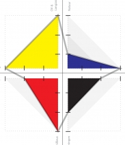
| butterfly model: integration between network and urban space |
Butterfly model: Opportunities for nodes
A node is a place where different modes of transportation meet and a variety of urban activities take place. Improving the integration between the network and the urban space can be very rewarding. To obtain a greater understanding of this a so-called ‘butterfly’ model has been developed which is based on three distinctive features for node (network) and three distinctive features on place (physical space). Decisive for the node value of a station in the butterfly model is its position in the public transportation network, the road network and the slow traffic network. Decisive for the place value of a station is the density of inhabitants, employees and visitors, the degree of functional diversity and its proximity, i.e. to what degree is the station itself a centre in its surroundings. The butterfly model positions these six characteristics in relation to each other: with the ‘node value’ on the left wing, and the 'place value' on the right wing. The butterfly functions best when both wings are in balance with each other.
Based on the demand for different housing and working environments, a series of twelve promising station typologies have been developed. Such typologies allows different stations along a railway line and in a railway network to develop complementary, so that they do not compete each other. The twelve typologies are ideal-typical situations. The difference between the butterfly representing the current situation and the one representing the promising situation directly indicates the task that is at hand.
|
SprintCity in your city(region)? Interested in applying SprintCity in your country or metropolitan area?
Contact us at | SprintStad@deltametropool.nl | More info at | SprintCity - international | |
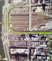
Corridors
The ideal level at which to coordinate transit-oriented development is the corridor level, i.e. a railway line operating at a regional level and the land surrounding the stations of that line. On this level it is possible to coordinate daily activity and movement patterns, and to fully optimize the accessibility, sustainability and agglomeration opportunities. The corridor also seems to be the most logical unit on the administrative level.
There are various types of corridors: residential corridors, mixed corridors and destination corridors. Depending on the type of corridor, the degree of control and the need to coordinate differs. In the 'ideal corridor’, living, working and amenities are evenly distributed, allowing the network to be efficiently utilised during peak and off-peak hours. Mixed use creates a lively area during the whole day. When stations within a corridor reinforce rather than compete each other, a daily urban system is created: stations along a railway line then form a complete city.

| click on image for larger corridor map |
In the province of Noord-Holland eight corridors are appointed. These corridors either start or end at the Ring of Amsterdam at Amsterdam Central station or Amsterdam South station. By confronting the demand for living and working with the identified plans, it becomes clear how promising the station typologies will be and what challenges this will bring along.
- The Ring of Amsterdam
is the most important destination in the province of Noord-Holland. Adding jobs, facilities and homes, transforming some of the vacant office supply and simultaneously improving the link between the entire public transport chain and the care and the bicycle, the station areas on the ring can become vibrant and mixed urban destinations that are able to effectively capture and spread large passenger flows to and from the city. - The Zaan corridor
with its distinctive character can make a unique contribution to the development of the metropolitan area of Amsterdam. The planned increase of train frequencies offers opportunities to strengthen this corridor by means of a more mixed programme and new homes in urban living environments. - The Schiphol (airport) corridor
is both a national and a regional destination. By separating regional and national traffic flows, the traffic flow around Schiphol airport can be improved. Furthermore, mono-functional office areas can be enlivened by the accumulation of urban activities such as residential areas and facilities, and by transforming a part of the vacant offices. - The Amsterdam – Utrecht corridor
connects two strong, relatively equal employment centres. In combination with the good multi-modal accessibility, the existing functional diversity and the planned increase of train frequencies this corridor offers opportunities for additional varied program. - The Amsterdam - Almere – Lelystad corridor,
where an increase of train frequencies is planned, can be utilised more effectively. Attracting jobs and regional facilities to Almere shall counter peak traffic flows and transform Almere into a more complete, versatile city. - The Zuid-Kennemerland corridor
can be enhanced both spatially and in terms of transport by further developing its existing residential qualities. The numerous natural and recreational areas in the immediate surroundings of the stations can be made more accessible for the whole region. - The Gooi corridor
is a fairly urban corridor, which makes it difficult to add new housing units in addition to the existing plans. Adding new jobs and facilities in the Gooi area will invigorate the stations and help to encourage counter peak traffic flows. - The Amsterdam-Enkhuizen corridor
has many identified plans. A good coordination of housing plans, allows a large part of the regional demand for housing to be realised in this corridor. This will encourage train use. - The Den Helder - Alkmaar corridor
is the destination backbone in the sparsely populated northern part of Noord-Holland. This area needs to respond to changing demands that are brought about by an aging population and high levels of structural vacancies. Facilities, jobs and houses should as much as possible be concentrated around the stations of the corridor. In this way they remain accessible for people without a car. This will ensure that high-quality public transport will continue to exist in this shrinking region.

The Zaancorridor as a case-study
Despite all the opportunities available, transit-oriented development in practice is not really taking off. Dominant actors such as governments and developers are losing their position or assuming a different role. Existing business models are failing with no prospect of an alternative model. Innovations in governance, regulation and funding are necessary to provide an effective and viable development strategy. In this context, the Zaancorridor serves as a case study. With an accustomed version of the serious game SprintCity and a specific process and organisational proposal, all parties have been invited to work together on its implementation.
What’s next?
Transit oriented development is a complex task addressing various issues simultaneously: a better utilisation of existing infrastructure, adjusting existing housing plans to meet market demand, prioritising plans around station areas as well as making prior investments in train frequency increases. This study demonstrates that a transit-oriented development strategy provides Noord-Holland many opportunities. Municipalities, provinces and transportation companies can benefit from working together on a comprehensive transit-oriented development strategy.
Even if everyone is convinced of the importance of TOD, local interests, commitments, land holdings and competition between municipalities remain a barrier. It takes administrative courage to push TOD forward on the agenda of the municipalities, transportation companies and market actors, to cancel plans or to invest first. Only if the province of Noord-Holland is unambiguous and fully committed to transit-oriented development, these opportunities can actually pay off.
| Read more ... | (English summary on pages 224-231)
Project partners

![]()
![]()

Vereniging Deltametropool werkt aan een NIEUWE UITSTRALING en aan een nieuwe WEBSITE! Onze bestaande website is momenteel niet up to date, onze excuses ervoor.

Boekpresentatie en debat:
'Het volgende landschap'
Wat kunnen we leren van de Landschapstriënnale?
28 mei in de Tolhuistuin
Toekomstverkenning
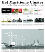
van het maritieme cluster en het belang van een regionale ruimtelijke strategie
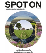
Spot On - het landschap als vestigingsvoorwaarde. Publicatie (2017) over de inzet van het Nederlandse landschap in het economisch vestigingsklimaat?

In dit retrospectief blikt Vereniging Deltametropool terug op een veelbewogen jaar.
Verstedelijkingsopgave van Nederland
IPO, G4 en G32 zochten voor het eerst naar een gezamenlijke aanpak voor de Verstedelijkingsopgave.
'Energie & Ruimte - een nationaal perspectief’ presenteert een nationale visie op de energietransitie en haar ruimtelijke impact.
Voor Bicycle Landscape fietste Yorit Kluitman door alle 388 Nederlandse gemeenten en fotografeerde het open landschap, zonder mensen of bebouwing: een dwarsdoorsnede van het geordende Nederland. Zijn drijfveer is een fascinatie voor de georganiseerde grafische structuur van de open ruimte.

Manifest Binnenstedelijke Gebiedstransformaties. De vereniging en het College van Rijksadviseurs ondersteunen dit manifest van diverse partijen.
Drechtsteden, maritieme top woonlocaties. Inventarisatie van ontwikkellocaties. Het ontwikkelde model koppelt ruimtelijke kwaliteiten aan woonwensen.
NOVI NU bundelt vier essays rondom de thema’s Next Farming, Next Living, Next Economy en Next Energy.
Publicatie Blind Spot bespreekt het belang van een hoogwaardig landschap voor het vestigings-klimaat, aan de hand van tien metropolitane regio's wereldwijd.
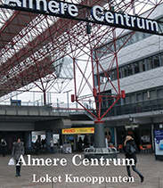
Werkboeken: Loket Knooppunten 2015 In de vier stationsgebieden Almere Centrum, Oss, Nijmegen en Eindhoven wordt de ontwikkeling gestimuleerd.

Met de nieuwste Stadsnatuurkaart Rotterdam kan je op zoek naar de Rotterdamse wildernis en de natuurlijke stad beleven. Op naar een coherent stadsnatuur netwerk!
City Deal Binnenstedelijk Bouwen en Transformatie De vereniging heeft deze City Deal, op 24 maart 2016 te Den Haag, mede ondertekend.
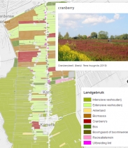
DialogueMaps: interactief kaart-instrument voor landschapswaard-ering, gericht op gebieden met complexe waarderingsdiscussies in het (stedelijk) landschap.
Duurzame Verstedelijking & Agglomeratiekracht Studie naar en pleidooi voor een integrale verstedel-ijkingsstrategie om de internationale concurrentiepositie te vergroten.
Oproep Vereniging Deltametropool roept op tot metropolitane strategie en agenda voor Nederland. Randstad is niet genoeg! #deltametropoolnederland
Opgave van de Maand een nieuwsbrief die iedere maand één van de 12 onvermijdelijke opgaven van het Jaar van de Ruimte belicht.
Werkboeken: Loket Knooppunten Met de selectie van drie stations-gebieden in de provincie Noord-Holland ging het Loket Knooppunten (CRA) van start.
Internationale Connectiviteit van de Zuidelijke Randstad Een Kwalitatieve vergelijking van de Zuidelijke Randstad in internationaal perspectief.
Duurzame TOD van Qinghe Station Verslag van een werkweek in Beijing, genaamd 'The Sino-Dutch Approach', over Transit-Oriented Development van Qinghe station.
Update - SprintStad #6 geeft inzicht in de geboekte vorderingen in 2013 en een vooruitblik op 2014 en verder. Het is de laatste Update in de serie.
Publicatieoverzicht van het thema Metropolitane Strategieën. Ook vindt u hier een overzicht van alle themabijeenkomsten.
Publicatieoverzicht van het thema Ruimte en Mobiliteit. Ook vindt u hier een overzicht van alle themabijeenkomsten.
Publicatieoverzicht van het thema Landschap van de Deltametropool. Ook vindt u hier een overzicht van alle landschapsbijeenkomsten.
Knooppunten in Stadsregio Rotterdam Met het opstellen van stationsprofielen is de differentiatie van 9 knooppunten in de Stadsregio Rotterdam in beeld gebracht.
Het Manifest en Werkboek voor het Metropolitane Gebied Leiden is een eerste aanzet om het metropooldenken op de regionale agenda te krijgen.
De publicatie Maak Plaats! geeft een nieuwe visie op ruimtegebruik en is een co-productie van Vereniging Deltametropool en de Provincie Noord-Holland.
New York - de Impact van Metropolitane Interventie , een artikel dat de invloed van een actie- groep op het grote investerings- kapitaal in New York beschrijft .
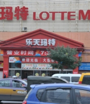
Tijdens de Beijing Design Week 2013 boog een groep Nederlandse experts zich onder de naam 'The Sino-Dutch Approach' over de herontwikkeling van Fengtai.
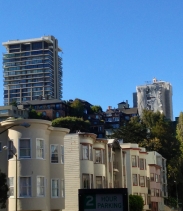
Metropolitaan reisverslag: Wat gebeurt er in Amerika? serie over de metropolitane ontwikkeling in de San Francisco Bay Area, zoals opgetekend door Jaap Modder.

Column De Nieuwe Deltametropool over metropoolvorming op wereldschaal, geschreven door Jaap Modder naar aanleiding van de INTA36 conferentie.
Metropolitaan reisverslag: Wat gebeurt er in ...? serie met inkijk in de metropolitane ontwikkeling in het Midden-Oosten en Azië, zoals opgetekend door Jaap Modder.
Update - SprintStad #5 toont een actueel overzicht van het 'work in progress', een vooruitblik op de doelstellingen voor 2013 en meer.

Brief aan kabinetsinformateurs: “Nederland heeft visie op metropolitane ontwikkeling nodig om in grootstedelijke slag overeind te blijven”.
Update - SprintStad #4 toont de nieuwste ontwikkeling van serious game naar planning support tool, resultaten van de stations-inventarisatie en meer.
Onderzoek naar de invloed van serious game SprintStad op beleidsontwikkeling, afdeling Planologie - Universiteit Utrecht.
Publicatie: BESTNET, inventarisatie van Transport Oriented Development in Nederland. Een inspirerend beeld van de kansen en opgaven. De publicatie is online te bestellen.
Eind februari 2011 is Hollandblad #8 uitgekomen. Dit nummer heeft als thema Bereikbaarheid, bottom-up.
Update - SprintStad #3 behandelt ondermeer de nieuwe versies van de serious game, onderzoeksresultaten en de planning van het project.
De FactSheet informeert leden van de vereniging over (opmerkelijke) feiten die een bestaande of toekomstige discussie binnen de Deltametropool kunnen beïnvloeden.
Het Jaaroverzicht 2010 laat zien op welke activiteiten, publicaties en projecten de vereniging in 2010 heeft ingezet.
Kiezen voor 4, 3 of 0 vraagt in artikelvorm aandacht voor de bestuurlijke opschaling van de Randstad in het verkiezingsdebat voor de Provinciale Staten 2011.
Het gezamenlijke opiniestuk uit de vakgemeenschap Supersnelweg, quo vadis? naar aanleiding van het recente regeerakkoord.
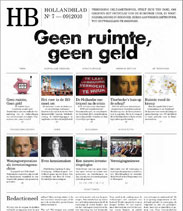
Begin september 2010 is Hollandblad #7 uitgekomen. Dit nummer heeft als thema 'Geen ruimte, Geen geld'.
Brief aan informateurs: om uit de crisis te komen is ontwikkeling van de Randstad tot een topregio urgenter dan ooit.
Eind april 2010 is de zesde editie van het Hollandblad uitgekomen. Dit nummer heeft als thema 'Angst voor de Metropool'.
Update - SprintStad #2 beschrijft ondermeer de spelsessie-evaluaties, het prototype, de debatbijeenkomst, betrokken partijen en de planning van project SprintStad.
De nieuwsbrief Private Picks biedt een platform voor interessante initiatieven, ideeën en evenementen omtrent metropolitane ontwikkeling.
Het jaaroverzicht 2009 laat zien op welke activiteiten, publicaties en projecten Vereniging Deltametropool in 2009 heeft ingezet.
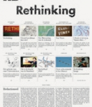
Eind september 2009 is het laatste Hollandblad uitgekomen. Dit vijfde nummer is geheel vernieuwd en heeft als thema 'Rethinking'.
Update - SprintStad #1 beschrijft ondermeer de achtergrond, onderzoeksvragen, uitgangspunten en voortgang van project SprintStad alsmede informatie over het spel.
De tafelrede 'Universiteiten in de Randstad' (Sijbolt Noorda) is de eerste uit een serie tafelredes uitgesproken tijdens de jaarlijkse AB-vergadering van de vereniging.
Het cahier Rewind | Play | Fast Forward verschijnt als sluitstuk van een reeks conferenties in 2008 en doet daarvan verslag.
De DVD International Review Standard 2040 n.a.v. de conferentie, met dezelfde titel, die op 15 en 16 december 2008 werd gehouden is uitgebracht.
Van het Hollandblad is de Zomer 2008 editie uitgekomen met als thema 'tussen Randstad Urgent en Randstad 2040'.

Het Hollandblad probeert op inhoudelijke en open wijze de discussie over metropoolvorming en ontwikkelingen die daarmee samenhangen een impuls te geven.