 Archief
SprintCity, a planning support tool for Transit-Oriented Development, has been succesfully applied to cases in The Netherlands. Recently there is a growing interest to apply this tool in other parts of the world, to support policy makers and transit companies in optimizing transport corridors, and help researchers in exploring the mechanisms behind TOD.
SprintCity has been developed over the last 5 years by the Deltametropolis Association, Delft University of Technology and Movares. Its prototype version was made possible by the Next Generation Infrastructures foundation.
Contact
| SprintStad@deltametropool.nl |
Read or download
| Make Space! - book on TOD in the Netherlands |
| SprintCity - project information |
| SprintCity - introduction video |
| Deltametropolis Association - an introduction |
| Update - SprintCity #6 | (PDF)
| Blog article on SprintCity by the Royal Town Planning Association |
| Full report of the SprintCity session in Bangalore | (PDF)
| Scientific paper on SprintCity simulation in Environment & Planning B | (coming soon)
SprintCity, an introduction
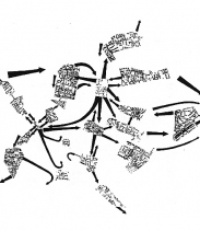
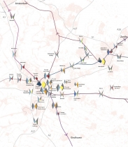
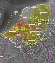
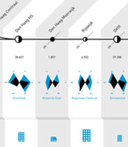
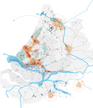
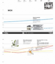
Planning support tool SprintCity simulates urban growth and train frequencies along a rail corridor, over a period of 20 years. The purpose of the tool is to give decision-makers insight into the relationship of spatial development and infrastructure, competition between municipalities and the specific qualities and opportunities of each station on a corridor. It also provides a safe platform to experiment with development strategies and collaboration between the different stakeholders.

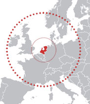
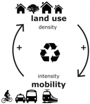
Transit-Oriented Development (TOD) is a promising urban model for densely populated areas, such as the Netherlands. The complexity of spatial planning and transport integration, as well as the fact that there is not a single responsible authority for TOD, is causing the current suboptimal use of rail infrastructure in The Netherlands. SprintCity was developed to help break these barriers.
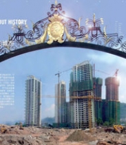
SprintCity has been used by more than 750 people, in more than 60 sessions, since 2009. It has been applied on 5 rail corridors in The Netherlands and implementation in Belgium is currently being studied. In principle, it can be used on any transport corridor (including Bus Rapid Transit), both existing corridors with existing and new stations, as well as new corridors or comparative corridor alternatives. Especially these latter applications may be relevant for metropolitan areas in developing countries.

SprintCity, working on an international basis
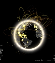
From the beginning, SprintCity ('SprintStad' in Dutch) has been a collaborative project, involving universities, government bodies and private enterprises. This approach has resulted in a user-friendly and widely tested tool: SprintCity v2.0. We believe that the application and further development of SprintCity should occur internationally. On the one hand, several entities abroad have contacted us to learn about this possibility. Consequently an English version is now being developed for this new group of international users. And on the other hand, co-development on an international scale will no doubt enhance the functionalities and applications of the next versions of SprintCity.
In this manner, the growing SprintCity community will be able to learn from each new experience and from the different policy- and development contexts worldwide. The source code of SprintCity is owned by the project partners, listed above. The data input and results, however, are always shared and made public. At this point, we are engaged with experts and government bodies in the following countries:
Flanders (Belgium)
In 2012 and 2013, there have been multiple SprintCity presentations and workshops in Flanders. For example at Turnhout (Spoorcongres 2013), the Province of Vlaams-Brabant and the University of Leuven, the Artesis University of applied sciences in Antwerp, the | Plandag 2013 | (in collaboration with Mapsup maptables and University of Utrecht). Implementation of the planning support tool on the rail corridor of the Schelde Landschapspark, in the Antwerp region, is being studied in close collaboration with Euro Immo Star, the development branch of NMBS Holding (Belgian Railways).

Sweden
In July 2013, the SprintCity planning support tool was demonstrated during the | ISAGA 2013 | conference. In this international setting, a discussion concerning the possibilities of implementing SprintCity in other European countries, Asia and the Americas was held. It became clear that the local planning challenges differ, according to development phase, planning traditions and socio-economic factors. Cases would range from developing metropolises facing rapid growth and lack of TOD planning to established but suboptimal urban areas facing stagnation and budget cuts. In all situations, however, there is demand for integration of urban development and transport, and interactive tools that quantify and visualize problems and possible solutions. Researchers at the | KTH university Stockholm | will possibly be involved in future SprintCity applications.


India
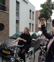
The first online simulation session of SprintCity was held in July 2013, organized by | Fields of View | (Bangalore and New Delhi) and the Deltametropolis Association (Rotterdam). The 3-hour session was operated from the three locations and facilitated by using Google+ Hangout. The teams in India managed to perform better on TOD at the | Zaancorridor | than the 'Business as Usual' scenario. Download the | full report | or read the | blog post | by Onkar Hoysala.
The application of SprintCity in the Indian context is still being studied. An English version of SprintCity has been demonstrated. The next step could be the implementation of a commuter rail corridor in Bangalore.

China
In 2010, an early version of SprintCity had already been presented in Shenzhen (NGI conference) and discussed with a decision maker of the MTR Corporation in Hong Kong. At the end of September 2013, SprintCity was featured at the | Beijing Design week 2013 |.
Other countries
Brazil - In order to understand the different TOD challenges worldwide, and the possiblities to address them with SprintCity, the planning support tool has been presented to others as well. In January 2013 we were invited by the innovation team of the regional planning department of São Paulo State Government (Inovaday). They were enthousiastic about the collaborative format of the tool, as it permits governments to work across borders and disciplines without establishing new (authoritarian) institutes. The alignment of public transport and urban growth in the metropolitan area of São Paulo is an urgent and complex issue, that requires a pragmatic and collaborative approach.
Australia - In 2012, TOD experts Carey Curtis, Jan Scheurer and Roger Mellor, of the Curtin University (Perth) and RMIT (Melbourne) visited us. It became clear that the fundamental mechanisms behind land use - transport integration are universal and tools like SprintCity could work in different contexts, when customized for the specific problems and in the local language. The possibility to work together on a project in Australia, integrating SprintCity with SNAMUTS, their public transport accessibility benchmarking tool was discussed.
Turkey - Similar possibilities are being explored for the metropolitan area of Istanbul in collaboration with| Embarq Turkey |, an international NGO for sustainable transportation.

SprintCity, the format
In order to include human decision making in the simulation, SprintCity has the format of a role playing game (ideally played by the real stakeholders), supported by a computer model with realistic data input. It features three types of players:
1. The Province/Region-player controls the overall development of the corridor, and needs to find an optimal location for regional functions, such as a hospital or educational facility;
2. The Transport-player controls the time table of the rail services on the corridor, and aims to increase ridership while running a profitable service;
3. The Municipality-players control the land use plans of each station area, and aspire to develop these areas according to previously chosen ambitions and a master plan.
Available train capacity, phased development areas and limited market demand for housing, offices and amenities provide natural bounderies to the system.

|
SprintCity in your city(region)? Interested in applying SprintCity in your country or metropolitan area?
Contact us at | SprintStad@deltametropool.nl |. |
Project partners:

![]()
![]()
The New Planning is a collaborative research project between Deltametropolis Association and TU Delft. A consortium of academic, civil society, government and market sectors is being created to meet the urgent need for a new model of strategic spatial planning that will keep the Netherlands at the forefront of territorial governance.

Rotterdams groen krijgt een eigen serie.
Op de publicatie “Investeringsstrategie voor Duurzame Verstedelijking” wordt er vanuit verschillende perspectieven gereflecteerd, 4 september HNI.
Landschap als Vestigingsvoor- waarde. We gaan door tot 2020! Sluit u nu aan bij de Community of Practice.

Opportunistic Urbanism is a two-way exchange between two contrasting metropolises: Melbourne, and Southern Randstad
(Closing event, Sept 7).
Agenda Vereniging Deltametropool
NEPROM, Melbourne en Landschap als Vestigingsvoorwaarde
Teken ook ons Pleidooi 2050 waarin gepleit wordt voor een nationaal programma voor een goede ruimtelijke strategie voor de energietransitie.
Voor zover bekend hebben we de bestaande energiestrategieën in kaart gebracht.
Mist u hierbij uw regionale strategie? Neem dan contact met ons op!
Metropool Forum 2018
Op 18 mei organiseerden we het 6e Metropool Forum. Bekijk hier het programma met alle deelnemers uitgelicht.
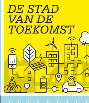
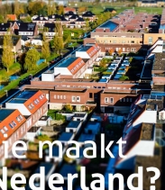
De grote steden van Nederland vormen de internationale gateways van het land. Op 10 januari 2018 ging de ontwerpstudie ‘De stad van de toekomst’ van start.
RE(OS)flecties III: het derde debat in samenwerking met REOS | metropool oploop
Vereniging Deltametropool is verhuisd.
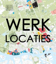
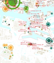
Werklocaties MRDH
in kaart gebracht | Metropoolregio Rotterdam Den Haag
Utrecht groeit snel, in minder dan 15 jaar moeten er 30.000 woningen gerealiseerd worden: een goede balans tussen netwerk en ruimte is dan essentieel.
Eurodelta-metropool: Hoe versterken we de internationale slagkracht van het gebied opgebouwd uit de Randstad, het Ruhrgebied en de Vlaamse Ruimte en het tussengelegen gebied.

Een interview met Joost Schrijnen over de publicatie 'Verstedelijkingsopgave van Nederland – naar een gezamenlijke aanpak'
NL CS, de knooppunten van provincie Utrecht uitgelicht. Over het behouden en versterken van de kwaliteiten van de regio met de grote opgaven.
Landschapstriënnale 2017. Vereniging Deltametropool is dit jaar één van de curatoren. Bekijk hier ons programma.
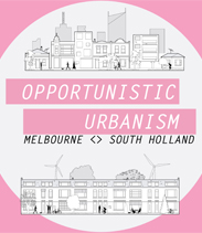
Opportunistic Urbanism is a two-way exchange between two contrasting metropolises: Melbourne, and Southern Randstad
(Closing event, Sept 7).
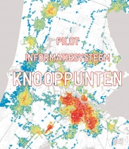
Informatiesysteem Knooppunten. Dit systeem biedt ondersteuning bij beantwoording van beleidsvragen, door slimme combinaties van beschikbare, openbare data.
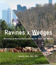
Workshop Toronto on Metropolitan Landscape. Canadian and Dutch professionals discussed how to use green infrastructure as a tool for attractive and livable cities.
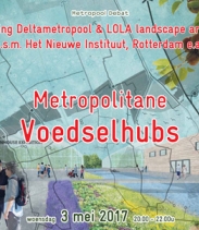
Metropolitane Voedselhubs. Een debatavond over de voedselvoor-ziening van de MRDH, bij het Nieuwe Instituut te Rotterdam (woensdag 3 mei 2017).
Maritieme (Ruimtelijke) Hotspots. Een samenwerking met drie ontwerpteams aan de Toekomst-verkenning van het Maritieme Cluster in Zuid-Holland.
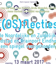
RE(OS)flecties II Debatbijeenkomst over de Ruimtelijk Economische Ontwikkelstrategie. Een verkenning met reflecties door vier 'unusual suspects' (13 maart, Utrecht).
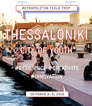
Metropolitan field trip Thessaloniki: City of Youth! How to broaden the dialogue for a shared vision of the future in metropolitan regions (6-9 October)!
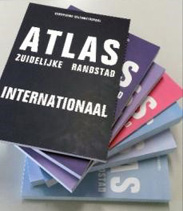
Atlas Slimme Verstedelijking De atlas is zowel een statement over het onderbenutte potentieel in onze steden als een uitnodiging voor een nieuwe manier van werken.
Metropool Forum 2016 Publiek forum over de ruimtelijke ontwikkeling van NL. Bijdrages van deskundigen en betrokkenen staan centraal (2 juni, Lelystad).
Deze IABR Special kijkt naar de grotere schaal voor ruimtelijke en economische planning, het ABC van een internationaal stedelijk perspectief voor NL (21/6, R'dam).
International Roundtable: Towards a Metropolitan Project several European metropolises exchange knowledge on metropolitan development (May 25, 2016, Paris).
De vereniging doet een agenda-voorzet voor de broodnodige metropoolvorming in Nederland. Een eerste diner pensant met experts en bestuurders vond plaats op 29/2.

Metropolitan field trip Turin: Building a Metropolitan Identity! How to broaden the dialogue for a shared vision of the future in metropolitan regions (17-20 March)!
RE(OS)flecties Debatbijeenkomst over de Ruimtelijk Economische Ontwikkelstrategie. Een verkenning met reflecties door vier 'unusual suspects' (3 maart, Utrecht).

Uitvraag: Leefomgeving van de Toekomst Uitvraag voor innovatieve projecten; met een substantiële bijdrage aan de leefomgeving van de toekomst (deadline, vrijdag 2 okt).
Metropolitaan Voedselcircuit MRDH Debatbijeenkomst over de toekomst van de voedselvoorziening in de MRDH. Gesprek met experts, bestuurders en ondernemers (8 okt).
NUVit seminar: Borrowed Size The NUVit initiative brings together case studies & practical experience from integrated infrastructure and spatial development (Sept 3, Brussel)
Metropool Forum 2015 Publiek forum over de ruimtelijke ontwikkeling van NL. Bijdrages van deskundigen en betrokkenen staan centraal (26 mei, Dordrecht).
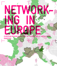
Networking in Europe Een internationale vergelijking van regio's die interessant zijn als partner voor de Zuidelijke Randstad, i.v.m. de European Urban Agenda.
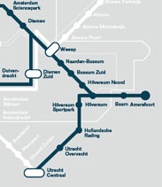
Voor de Gooicorridor wordt vanaf januari 2015 een toegespitste versie van Planning Support Tool SprintStad ontwikkeld.
Metropolitan Field Trips explore and showcase innovations in urban development in European cities. Join us on one of our trips!
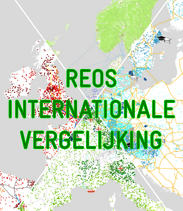
REOS Internationale Vergelijking Een internationale vergelijking voor de selectie van internationale stedelijke regio’s als goed voorbeeld voor het REOS proces.
Startbijeenkomst Jaar van de Ruimte 2015 met presentatie van het Openingsbod, documentaire en publicatie (15 januari, Amsterdam).
Jaar van de Ruimte We staan stil bij het resultaat van 25 jaar grote visies en plannen en vragen ons af welke opgaven de komende 25 jaar onvermijdelijk zijn.

Metropolitan field trip Copenhagen-Malmö Join us and study the dynamics of this Northern European metropolis. How does the urban planning work? (20 - 23 Nov)
Werken aan Stedenbaan Diverse projecten zoals vraaggestuurde analyses en alliantiegesprekken. Ook het vlindermodel toegepast op De Oude Lijn.
Metropolitan field trip Budapest Join us and study the dynamics of this Eastern European metropolis. How does the urban planning work? (9 October - 12 October)
Metropolitan field trip Rome Join us and study the dynamics of this Southern European metropolis. How does the urban planning work? (28 September - 1 October)
Metropolitane Strategieën is één van de hoofdthema's van de vereniging; wat kunnen we van welke internationale voorbeelden leren en waar willen we naar toe als Deltametropool?
Mobiliteit en Ruimte is één van de hoofdthema's van de vereniging; bereikbaarheid is een rand- voorwaarde voor de ontwikkeling van onze Deltametropool.
Landschap van de Deltametropool één van de hoofdthema's van de vereniging; het landschap is een voorwaarde voor stedelijke kwaliteit en leefbaarheid.
Spannende Vragen in de Kunsthal Bijeenkomst met presentaties en discussies over de toekomst van de ruimtelijke ordening in Nederland (4 juli, Rotterdam).
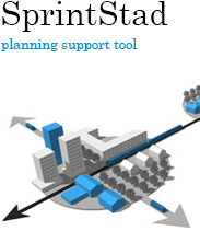
Planning Support Tool SprintStad is een simulatiespel over de gelijktijdige ontwikkeling van stationsgebieden en ov-mobiliteit.
Het Veenweidegebied van de Deltametropool staat aan de vooravond van grote veranderingen. Lees meer over het onderzoek.
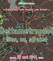
Deltametropool: Toen, Nu, Straks! Een debat over bijna 15 jaar ontwikkeling van het metropolitane stedelijke netwerk in Nederland (dinsdag 27 mei, Den Haag).
Metropool Forum 2014 Publiek forum over de metropolitane ontwikkeling van NL. Bijdrages van deskundigen en betrokkenen staan centraal (30 juni, Amsterdam).

Metropolitan field trip Boekarest. 'Stad in Transitie'. Grootstedelijke verkenning, doe inspiratie op voor de nieuwe stad! Van 24 t/m 27 mei 2014.
SprintStad Zuid-Kennemerland is de nieuwste corridor in het SprintStad-model. Van onrendabele spoorlijn naar drager van de regio?

Cultural Clusters as a Commodity for Cities is a research into how local cultural clustering works; what is specifically local and what is specifically global about it?
Stuur op de Metropool! Een debat-bijeenkomst over governance en internationale concurrentiekracht in metropolitane regio's (maandag 16 december, Amsterdam).
International Roundtable: From Strategies to Implementation was een bijeenkomst op 14 november te Brussel over Europese metropolen. Presentaties, verslag beschikbaar!
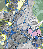
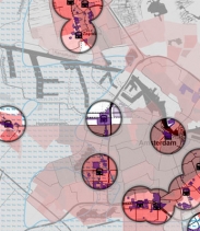
Ontwikkeling van mobiliteit en ruimte op Zaancorridor wordt onderzocht met planning support tool SprintStad d.m.v. simulatiesessies met stakeholders.
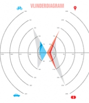
Knooppuntontwikkeling: Typologie en Vlindermodel is een door de vereniging ontwikkeld model met 6 onderscheidende kenmerken voor knoop- en plaatswaarde.
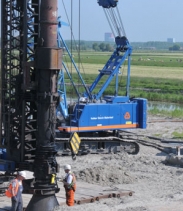
De Verdienmodellen van Transferia was een symposium over nieuwe strategieën voor transferia en P+R locaties, een volledige business- case werd bekeken (1 nov, Delft).
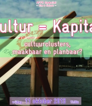
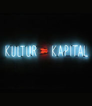
Kultur = Kapital was een Special tijdens het AFFR met debat en filmfragmenten over culturele clustering in Rotterdam en Berlijn (11 oktober, LantarenVenster).
Creating Innovative Production Environments is a spatial design-testing strategy for Delft and Leiden. It works towards redevelopment strategies for certain clusters.
P+R, de quick wins was een vak- excursie en themabijeenkomst in de reeks gericht op het verbeteren van knooppunten c.q. P+R-terreinen (19 september, Rotterdam).
Cultuurclusters als Activa voor Steden, Maakbaar en Planbaar? onderzoekt de invloed van lokaal ruimtelijk beleid op het netwerk van clusters en de creatieve klasse.
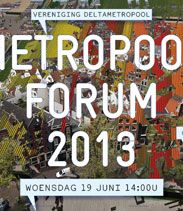
Metropool Forum 2013 Publiek forum over de metropolitane ontwikkeling van NL. Bijdrages van deskundigen en betrokkenen staan centraal (19 juni, Stadhuis Delft).
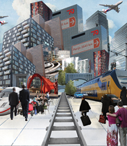
iNode is het prototype van een online informatiesysteem voor Transit-Oriented Development in Nederland. Relevante informatie voor iedere gebruiker.
The Seven Year Itch, een debat-bijeenkomst over trendverandering tijdens zeven jaar ruimtelijke ordening met Henk Ovink (26 maart, Den Haag).
Werkweek: Metropool NL Op basis van de conclusies uit de tIP-reeks worden voor een aantal situaties ontwerpen gemaakt ter versterking van de Nederlandse metropool.
Driving Competitiveness in the North Wing Presentatie van RRAAM adviezen door de London School of Economics, CRA en RRAAM-werk (11 februari, Amsterdam).
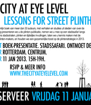
The City at Eye Level is een stadssafari en boeklancering over plinten in de stad met keynote van John Worthington (11 jan 2013, Rotterdam).
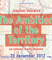
The Ambition of the Territory is de Metropool Oploop over een nieuwe visie op stedelijke ontwikkeling in Europa (20 dec, Atelier College van Rijksadviseurs te Den Haag).
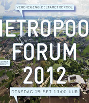
Metropool Forum 2012 Publiek forum over de metropolitane ontwikkeling van NL. Bijdrages van deskundigen en betrokkenen staan centraal (29 mei, Utrecht).
Planning support tool SprintStad v1.2 ondersteunt strategische beleidsvisies Utrecht door simulatie van ontwikkelingen op Utrechts spoorcorridor.
SprintCity planning support tool was presented among international TOD experts at the BUFTOD 2012 conference in Paris (Marne-la-Vallée).
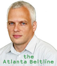
the Atlanta Beltline Urban planner Ryan Gravel (USA) gave a lecture on this grassroots TOD success and participated in an expert discussion on international TOD practices.
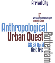
Rotterdam Bright Future A two-day programme on lessons for planning after the crisis, with +/- 25 professionals from various countries. April 26/27, 2012.
Antropoloog in Eigen Stad slot- bijeenkomst waarin terugkoppeling plaatst vindt n.a.v. de bijeenkomsten in februari 2012 te Rotterdam, Den Haag, Utrecht en Amsterdam.
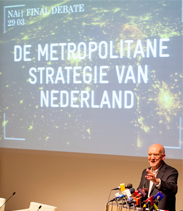
tIP Final Debate: de Metropolitane Strategie van Nederland. Zijn we klaar voor de concurrentie met de internationaal groeiende metropolen? Donderdag 29 maart.
Verslag van de debatavond 'Nieuwe regels, nieuwe kansen'. met bijna 250 bezoekers.

Lecture series the International Perspectives (tIP) focuses on which activities or facilities are important for Randstad Holland and it needs to strive for.
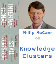
tIP 07|07: Knowledge Clusters. A lecture by Philip McCann on the role of higher education institutions in their local economy. Thursday March 8, 2012 in Amsterdam.
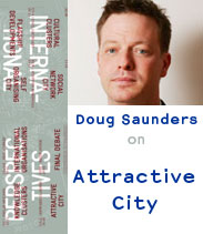
tIP 06|07: Attractive City. A lecture by Doug Saunders on the importance of facilities in attracting new inhabitants. Thursday February 16, 2012 in Leiden.
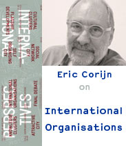
tIP 5|7: International Organisations. A lecture by Eric Corijn on how the international character of The Hague can contribute to its development. Thursday January 26.
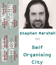
tIP 04|07: Self Organising City. A lecture by Stephen Marshall on how cities are put together. Thursday November 24, 2011 in Rotterdam.
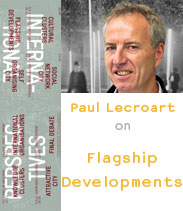
tIP 03|07: Flagship Developments. A lecture by Paul Lecroart on how flagship developments fit into national development strategies. Thursday November 3, 2011.
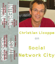
tIP 02|07: Social Network City. A lecture by Christian Licoppe on the development of Urban Public Places into ‘Hybrid Ecologies’. Thursday October 13, 2011.
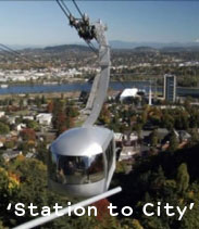
Interactive video debate 'Station to City', on international practices of Transit Oriented Development (TOD). Friday October 7, 2011.
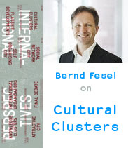
tIP 02|07: Cultural Clusters. A lecture by Bernd Fesel on the Creative Economy and Randstad Holland. Thursday September 22, 2011 in Delft.

Atlas ABC belicht de rol van Randstad Holland als onderdeel van ABC, het verstedelijkte gebied Amsterdam-Brussels-Cologne en biedt zo een raamwerk voor debat.
Siebe Riedstra, secretaris-generaal IenM, ging in zijn tafelrede, tijdens het Algemeen Bestuur, in op de integratie van de beleidsvelden Ruimte en Infrastructuur bij IenM.
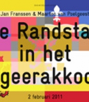
Vereniging Deltametropool organiseert een Randstad Oploop over de Randstadpassages in het Regeerakkoord. Met Jan Franssen en Maarten van Poelgeest.
Defining the Metropolis is een historische beschouwing en internationale vergelijking van de ontwikkelpatronen van de metropool.
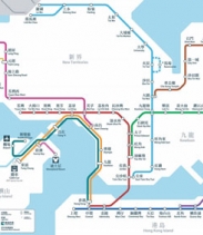
SprintStad ontmoet Parelrivier. Deltametropool verkende de metro van Shenzhen en Hong Kong, en sprak er met verschillende professionals. Een reisverslag.
SprintStad is gepresenteerd op de internationale conferentie 'Next Generation Infrastructure Systems For Eco-Cities', te Shenzhen van 11 tot 13 november 2010.
InteractieMilieus onderzoekt de uitwerking van specifieke interactiemilieus als opgave in de Randstad of als kans voor nieuwe ontwikkeling.
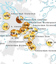
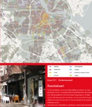
Als onderdeel van project SprintStad is een ruimtelijke inventarisatie van stationsgebieden in de Randstad uitgevoerd, tussen mei en juli 2010.
Serious game Sprintstad was dinsdag 14 september 2010 onderdeel van de Projectenparade Spoorzoneontwikkeling van het kennisplein Mooi Nederland (VROM).
De vereniging organiseert in reactie op de 'brede heroverweging'-rapporten een aantal bijeenkomsten die uitmonden in een advies aan het nieuwe kabinet.
Openbare debatbijeenkomst Hoe ver is de OV-stad? op 11 maart 2010 van 13:00 tot 15:00. De Dependance, Centrum voor Stadscultuur te Rotterdam.
Neville Mars Lezing 'The Chinese Dream: Hoe wordt Nederland daaruit wakker?' . Over mega- polissen van 480 miljoen inwoners en hun betekenis voor Nederland.
Het Programma van de Metropool is een onderzoek naar de vorm en randvoorwaarden voor nieuwe stedelijke brandpunten in de Randstad.

Wat heeft de Randstad te bieden? Dat is het onderwerp van de Randstad Oploop 'Dat is de Kracht van de Randstad'.

Debatbijeenkomst 'De Randstad, dat zijn wij'. Wat kun jij doen voor de ontwikkeling van een sterke Randstad, in deze tijden van crisis?

'The Future Randstad' bijeenkomst is een groot succes geworden: met o.a. Bart Vink (VROM), John Worthington (London) en Robert Yaro (New York).
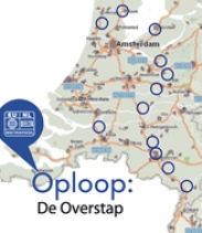
Waar en wanneer werkt overstappen tussen auto en openbaar vervoer? Dat is het onderwerp van de Randstad Oploop 'De Overstap'.
De conferentie 'Randstad ná Urgent' gaat in op het gat dat dreigt te vallen in de ruimtelijke planning tussen Randstad Urgent en Randstad 2040.
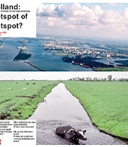
'Holland: Hotspot of Hutspot?' een werkconferentie over het nut en de noodzaak van een lange termijnvisie.
SprintCity's main goal is to identify opportunities for future developments around existing rail infrastructures, whilst simultaneously improving regional rail transport services.
Defining the Metropolis researches the influence of global top urban functions on the development of urban agglomerations in the world.